The fish in the sea, all that swim the paths of the seas.
I hadn't really thought about the word "paths" in Psalm 8, verse 8, before I read "The Old Ways" by Robert MacFarlane. This book has received several very good reviews in the UK, and when I borrowed it from the library, it came with the proviso that I could not renew it. [Here's an OR solution to the library problem of what to do about loaning popular items - just like students can borrow material on overnight loan. So I must:
(1) finish the book within 21 days; (2) return it unfinished and hope that I can borrow it again soon; (3) keep it out and pay the overdue fine. I intend to follow option (1)]
In the book, the author describes some of the old pathways that criss-cross the world, from the times when everyone who travelled, travelled on foot or on the back of an animal (donkey, horse, camel, elephant). The paths that people followed were not designed by engineers, they were pathways that satisfied numerous criteria about ease of following, shelter in bad weather, a destination and places to rest on the way. There are many such prehistoric paths in Devon, especially on Dartmoor. He mentions one on the moor which is marked with white stones to help travellers to avoid the numerous bogs and mires - think Grimpen Mire (below) in The Hound of the Baskervilles. W G Hoskins, the expert on interpreting local history in the UK, who came from Devon, mentions a medieval road that was used by farmers who drove their cattle to pasture on the high ground of Cosdon Hill (a corruption of "Cows" down) in the summer. I drove along it last month - it follows a straight line with the hill visible on the skyline, but in places it deviates from being straight to cross streams where the ground was firmer than in the marsh surrounding the springs which fed the stream.
Robert MacFarlane also discourses about some of the paths of the sea that have existed for millennia. In the book, he follows some of them in an open boat. He comments that travelling by water with a cargo was much more efficient than transport with pack animals until the Industrial Revolution offered canals, railways and well-made roads. And to illustrate his point, he asks the reader to imagine what a map of Europe would look like if the land areas were treated as impenetrable, and the sea and rivers were to be criss-crossed with "The paths of the sea". In an earlier blog, I mentioned the silver mines of Bere Ferrers - nearly all the mined material was moved by water, down the River Tamar, especially in the later years when the mines produced copper and tin and other minerals.
However, there were exceptions to the general rule "everything goes by water". Some of the paths of the seas converge on bays (not really ports or harbours) where goods would be transferred to pack animals (or humans) to be moved to another bay where the cargo would be reloaded into boats. Why? because prehistoric man knew that there were places where the risk of sinking in rough seas was so great that it was better to avoid such places. It is the OR solution to a special path problem - to find the path from A to B which has the greatest chance of being successful given the transport available. In Cornwall, one such place of risk was Land's End, and so the sea routes converge on St Michael's Mount in the south and Hayle estuary and St Ives on the north coast. And a well-used path linked the two. Other rocky headlands were treated in the same way.
John Norman, my mentor for the OR technique of Dynamic Programming, used to insist that we defined clearly what we meant by "optimal" when we derived DP recurrences. Is optimal: shortest? fastest? safest? cheapest? or what?
(1) finish the book within 21 days; (2) return it unfinished and hope that I can borrow it again soon; (3) keep it out and pay the overdue fine. I intend to follow option (1)]
In the book, the author describes some of the old pathways that criss-cross the world, from the times when everyone who travelled, travelled on foot or on the back of an animal (donkey, horse, camel, elephant). The paths that people followed were not designed by engineers, they were pathways that satisfied numerous criteria about ease of following, shelter in bad weather, a destination and places to rest on the way. There are many such prehistoric paths in Devon, especially on Dartmoor. He mentions one on the moor which is marked with white stones to help travellers to avoid the numerous bogs and mires - think Grimpen Mire (below) in The Hound of the Baskervilles. W G Hoskins, the expert on interpreting local history in the UK, who came from Devon, mentions a medieval road that was used by farmers who drove their cattle to pasture on the high ground of Cosdon Hill (a corruption of "Cows" down) in the summer. I drove along it last month - it follows a straight line with the hill visible on the skyline, but in places it deviates from being straight to cross streams where the ground was firmer than in the marsh surrounding the springs which fed the stream.
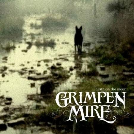 | ||
| An atmospheric image of the fictitious Grimpen Mire |
Robert MacFarlane also discourses about some of the paths of the sea that have existed for millennia. In the book, he follows some of them in an open boat. He comments that travelling by water with a cargo was much more efficient than transport with pack animals until the Industrial Revolution offered canals, railways and well-made roads. And to illustrate his point, he asks the reader to imagine what a map of Europe would look like if the land areas were treated as impenetrable, and the sea and rivers were to be criss-crossed with "The paths of the sea". In an earlier blog, I mentioned the silver mines of Bere Ferrers - nearly all the mined material was moved by water, down the River Tamar, especially in the later years when the mines produced copper and tin and other minerals.
However, there were exceptions to the general rule "everything goes by water". Some of the paths of the seas converge on bays (not really ports or harbours) where goods would be transferred to pack animals (or humans) to be moved to another bay where the cargo would be reloaded into boats. Why? because prehistoric man knew that there were places where the risk of sinking in rough seas was so great that it was better to avoid such places. It is the OR solution to a special path problem - to find the path from A to B which has the greatest chance of being successful given the transport available. In Cornwall, one such place of risk was Land's End, and so the sea routes converge on St Michael's Mount in the south and Hayle estuary and St Ives on the north coast. And a well-used path linked the two. Other rocky headlands were treated in the same way.
John Norman, my mentor for the OR technique of Dynamic Programming, used to insist that we defined clearly what we meant by "optimal" when we derived DP recurrences. Is optimal: shortest? fastest? safest? cheapest? or what?

Comments
Post a Comment